|
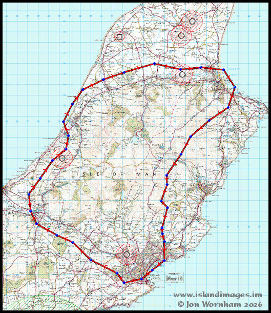
This is a map
that I made some years back fro my drone flying Operations Manual, showing
the extent of the TT Course Restricted Airspace. It starts 1,000
metres outside the course and includes all of the airspace within the red
line up to 3,000 ft above sea level.
|